

There’s more to a green pasture than meets the eye, especially when horses are involved. Healthy grazing land isn’t just a scenic backdrop, it plays a vital role in a horse’s overall well-being, influencing everything from digestion to behavior. Yet despite its importance, pasture management is often handled with a shrug and a hopeful eye on the weather. Many rely on routine or guesswork, rotating fields out of habit rather than understanding. The outcome is familiar and frustrating: worn-out grass, compacted soil, and land that struggles to recover season after season.
That passive approach is starting to shift. With live satellite images and analytics, landowners can finally see their pastures with clarity and precision. These tools reveal patterns and problems that would otherwise go unnoticed, making it easier to balance grazing pressure, protect soil health, and plan ahead.
Hidden Struggles Behind Healthy Grazing
Pasture management may look straightforward in theory: move the horses, let the grass recover, repeat. But anyone working the land knows it rarely plays out that smoothly. Grass grows unevenly. Weather patterns shift without warning. Some areas flourish while others turn to bare soil under constant trampling. And when every acre needs to support both animal health and long-term land use, the pressure to get it right can be relentless.
One of the toughest challenges is preventing overuse. When horses graze too long in one spot, the grass loses its ability to rebound. What starts as a patchy field can quickly become a worn-out stretch of dirt, opening the door to soil erosion and invasive plants. Then come the seasons. Spring might offer a burst of growth, giving a false sense of abundance, but summer heat or autumn rains can flip the script overnight. Without consistent visibility into what’s happening across the pasture, many decisions come too late. By the time the damage is clear, recovery takes time, effort, and in many cases, money that could have been saved.
Tools Transforming Pasture Management
Fortunately, land management is no longer limited to pacing the fields and relying solely on experience. A new generation of tools is transforming how ranchers and horse owners care for both their pastures and their animals. These innovations are not just convenient additions to old routines. They are changing the way we understand the land, helping people make decisions that are rooted in evidence instead of habit.
Drones are becoming a common sight on modern ranches, flying overhead to capture high-resolution images that reveal grazing patterns, soil wear, and even water buildup in low-lying areas. Instead of waiting for visible damage to appear, ranchers can now detect early signs of stress and act before problems take hold. Soil sensors provide another layer of insight, quietly monitoring moisture levels, pH balance, and nutrient availability around the clock. Combined with small-scale weather stations that track hyperlocal changes in temperature, wind, and precipitation, these tools help build a clearer picture of what is really happening at ground level.
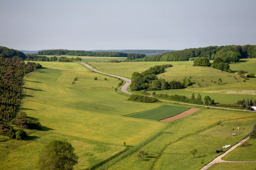
Perhaps the most revolutionary shift comes from above. With the ability to view live satellite images, landowners can now see large-scale patterns across their property that would be impossible to spot on foot. These satellite visuals show how vegetation is growing, where it's thinning, and how those trends change over days, weeks, and seasons. This kind of perspective brings a level of clarity that has never been available before. It turns guesswork into strategy, helping to protect the land from overuse while ensuring horses have access to consistent, high-quality forage.
How Satellites Guide Smarter Grazing Decisions
Satellite data is not just about seeing your pasture from above but about understanding it on a deeper level. When used for pasture mapping, this technology helps define the true boundaries and conditions of each grazing zone, identifying which areas are thriving and which ones are under stress. It takes the guesswork out of land management by turning distant pixels into clear indicators of ground-level reality.
With EOSDA LandViewer, these insights become both accessible and actionable. The platform allows users to track vegetation health across seasons, compare year-over-year changes, and flag trouble spots before they turn into larger issues. By analyzing plant vitality through vegetation indices like NDVI, LandViewer helps pinpoint where forage is strongest and where recovery is needed. This makes it easier to rotate animals strategically, reduce pressure on vulnerable areas, and make the most of every acre.
The ability to see live satellite images adds a real-time dimension to this process. Instead of waiting for signs of overuse to appear on the ground, managers can act early, adjusting grazing schedules or supplementing feed when needed. And because live satellite imagery captures the big picture, it reveals connections that might be missed in day-to-day observation: like how a dry patch in one field could be tied to drainage issues or how pasture health improves after a rest period. With these tools, grazing decisions become smarter, timing becomes sharper, and the land gets the care it needs to stay productive long term.
Greener Fields Through Smarter Strategies
By bringing together satellite technology, soil sensors, drones, and smart data platforms, pasture management becomes more precise and less reactive. These tools offer a clearer view of land conditions, helping to prevent overgrazing, support faster regrowth, and make better use of every acre. With accurate insights at their fingertips, ranchers can provide more consistent nutrition for their horses, protect soil health, and adapt to seasonal shifts before they become problems. In the end, this tech-driven approach leads to healthier animals, stronger pastures, and a more sustainable relationship between land and livestock.
You can find more interesting stories in our section on Health & Education.